 geo.be Metadata Catalog
Royal Belgian Institute for Natural Sciences (RBINS), Directorate Natural Environment (OD Nature), Ecosystems data processing and modelling (ECODAM)
Type of resources
Topics
INSPIRE themes
Keywords
Contact for the resource
Provided by
Years
Formats
Representation types
-

This dataset is part of the 2018 Belgian submission for the Marine Strategy Framework Directive (MSFD) linked to descriptor 6, criterion 2. This dataset describes and maps the physical disturbance to the seabed in the Belgian part of the North Sea (BPNS) between 2011 and 2016. The dataset combines different layers of human activities leading to a disturbance of the seabed, including power cables with its rock dump, dredging and dumping, extraction, war ammunition stocking and wind farms. The area disturbed is mapped and quantified per year, per activity and per benthic broad habitat.
-
This dataset is part of the 2018 Belgian submission for the Marine Strategy Framework Directive (MSFD) linked to descriptor 7, criterion 1. This dataset describes the impact of an offshore windmills farm on the hydrodynamics in the Belgian part of the North Sea (BPNS). Originally, it is a NetCDF file with the results of the reference simulation made with the COHERENS (COupled Hydrodynamical Ecological model for REgioNal Shelf seas) hydrodynamic model only forced by tides (no wind effect). Model resolution : ~ 12.5m. It contains both the reference situation which is a simulation without any windmill and the modeling result of the influence by the windmills on the hydrodynamic in the BPNS. The dataset contains the results on the most inner nested grid level for one reference spring-neap cycle: - hourly sea surface elevation - hourly bottom shear stress - hourly 3D horizontal velocity components (u,v) - hourly 3D eddy viscosity - time-averaged bottom shear stress over the reference spring-neap cycle - percentile 90 of the bottom shear stress for the reference spring-neap cycle - percentile 90 of the specific kinetic energy at the sea bed - accumulated time during which sedimentation processes are dominant - accumulated time during which re-suspension processes are dominant.
-
This dataset is part of the 2018 Belgian submission for the Marine Strategy Framework Directive (MSFD) linked to descriptor 8, criterion 3. This dataset gives an overview of the observed slicks during aerial survey operations of the Belgian part of the North Sea (2011-2016). Related to significant acute pollution, it includes the observations linked to the Flinterstar incident in 2015. Besides this, all observations of illegal discharges of MARPOL (International Convention for the Prevention of Pollution from Ships) annex I and II substances are included as an additional dataset.
-
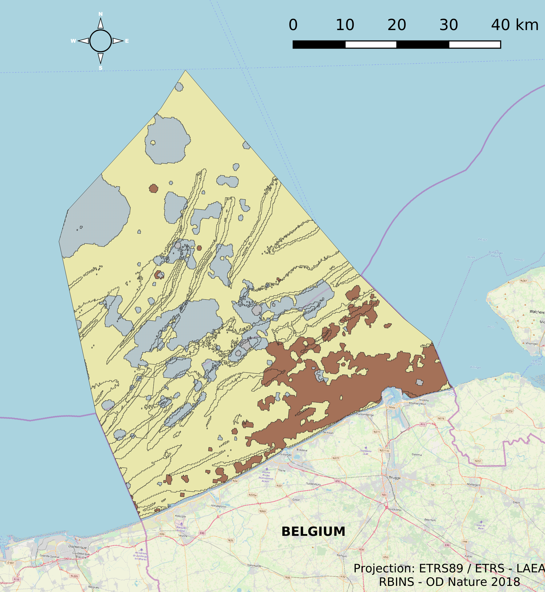
The dataset describes the physical habitats in the Belgian Part of the North Sea. It uses the EUNIS classification system as well as the MSFD Habitat codelist for the description and classification of the BPNS. It provides also information on the energy, biozone and type of substrate for the different areas in the BPNS.
-
This dataset is part of the 2018 Belgian submission for the Marine Strategy Framework Directive (MSFD) linked to descriptor 6, criterion 1. This dataset describes and maps the the physical loss of the seabed in the Belgian part of the North Sea (BPNS) in the period 2011-2016. The dataset combines the different human activities responsible for a loss of seabed, including wrecks, measuring piles and radar stations, pipelines, power and telecommunication cables with their rock dump, and wind farms. The area lost is mapped and quantified per year, per activity and per benthic broad habitat.